
Moab, UT

Moab during COVID-19
April 17-19, 2020
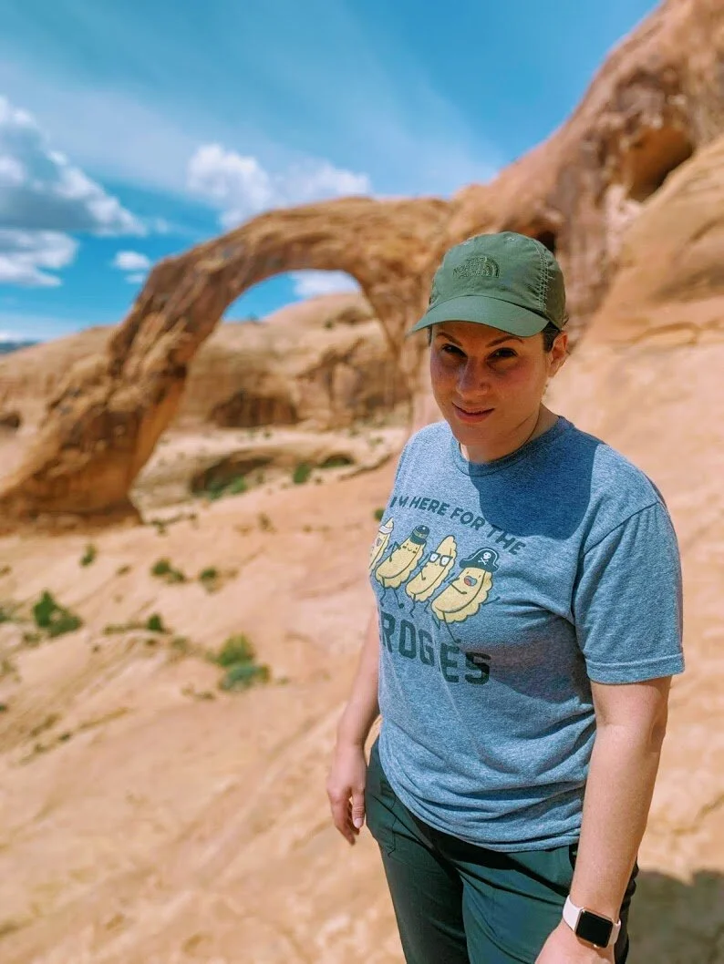
We woke up one morning and decided to take the six-hour hike to Moab, UT, on a whim. The drive to Moab from Denver is through the mountains, so it is a beautiful drive with a lot to see, which helps kill time. This trip was taken mid-COVID-19, so many things were closed, including Arches National Park.
The road to Moab
Living only six hours from Moab we figured to take a last-minute trip despite COVID-19. Now, before you get mad over us being out during a pandemic when we should have been inside note that we saw maybe ten people the entire time we were out, making this the best time to hike. Moab is vast and includes Arches National Park, which was closed, so that left us to venture into other parts of the area.
Day 1: Travel Denver to Moab
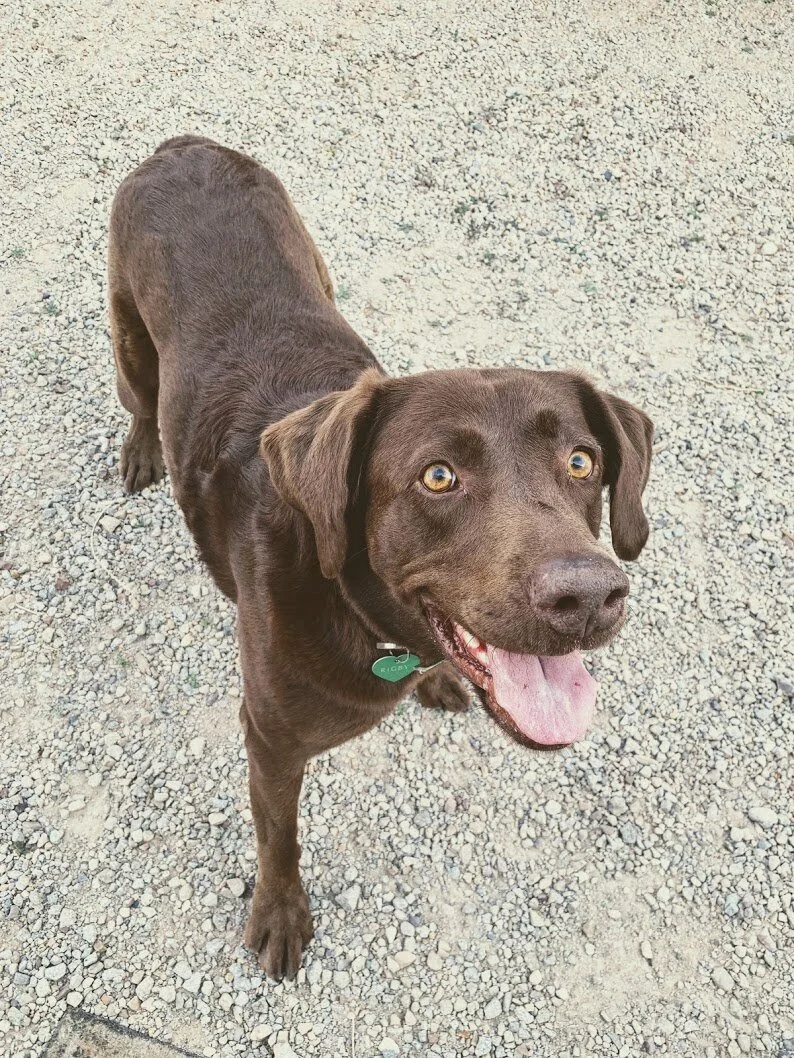
Before arriving in Moab we had to stop at a small gas station off of I-70 exit to Moab that looked like something out of this world. They had a variety of soda and beef jerky; a must stop even though it is slightly frightening. I assure you it is safe. We arrived in Moab later in the afternoon and went straight to our Airbnb, a camper in a small camping lot; this was the only option available, so we made ourselves right at home. The camper was rented from Fun Stays on Airbnb and it was such a pleasant stay, even Stephen was impressed by how nice it was and how big it was for how reasonably priced we rented it, we even met a new friend named Rigby, a chocolate lab. After we checked-in, we headed back into town to get some groceries for breakfast, and because most restaurants were closed.


Day 2: Exploring
- Petroglyphs
- Corona Arch and Bowtie Arch
- Long Canyon Rd
- Potash Ponds


The same map shown in three different styles
We started our morning by heading to the west side of Moab, where the majority of places were open to hike (pictured above is a map of our stops). Potash Road is where we spent the majority of the day. The road is beautiful as it follows the Colorado River. About 15 feet up on the rocks was a story of petroglyphs; I found it pretty amazing how high they were because, at one time, the ground was much higher in that area. Close to the petroglyphs was the trail-head to Corona and Bowtie arch.


The trail to the arches was reasonably easy being only three miles round trip, with a few fun obstacles such as holding safety cables while walking on rocks, climbing Moki steps, and climbing a ladder. At the beginning of the hike you can see Pinto Arch off to your left. Along the trail, wildflowers were starting to bloom to add to the beauty of the hike.


The hike was a basic trail with stone walkways and then you cross over to large slick rocks before coming around the bend to one of the best views (as seen below). Bowtie Arch on the left and Corona Arch on the right.


Seen above in the picture on the left is Corona Arch standing at 105ft. Little fact, back in the ’40s, planes would fly through the arch. I'm not sure about you, but that would be terrifying! The picture on the far right is Bowtie Arch and its natural hanging garden.


On the backside of Corona Arch, the rock face resembled a troll face to me, and from the side of the arch, it looks like a troll with his arm coming out at you.

Above is a panoramic view away from Corona Arch.
After hiking to the arches and back, we drove further into the canyon looking for Jug Handle Arch. Jug Handle Arch is at the corn of Potash and Long Canyon Rd. on the corner, but it is easy to miss. Beyond Jug Handle Arch is Long Canyon Road. Side note: Stephen just bought a new Tacoma and wanted to do some light off-roading, Long Canyon Rd. is a dirt road with its fair share of twists, turns, and many bumps but also spectacular views, I don't recommend driving on this road in a car. In the pictures below you can see many different formations on Long Canyon Rd.


My favorite part about Long Canyon Rd. was the view once you crawl up the steep road and look behind you. I found it unbelievable to see the warm sandstone cliffs backed by Mt Waas with its snow-capped mountains.
Placed between two tall cliff walls, we could hear so clearly, we started to yell and made noises and you could listen to the echos travel down the walls, I wonder if hikers could hear us in that moment.

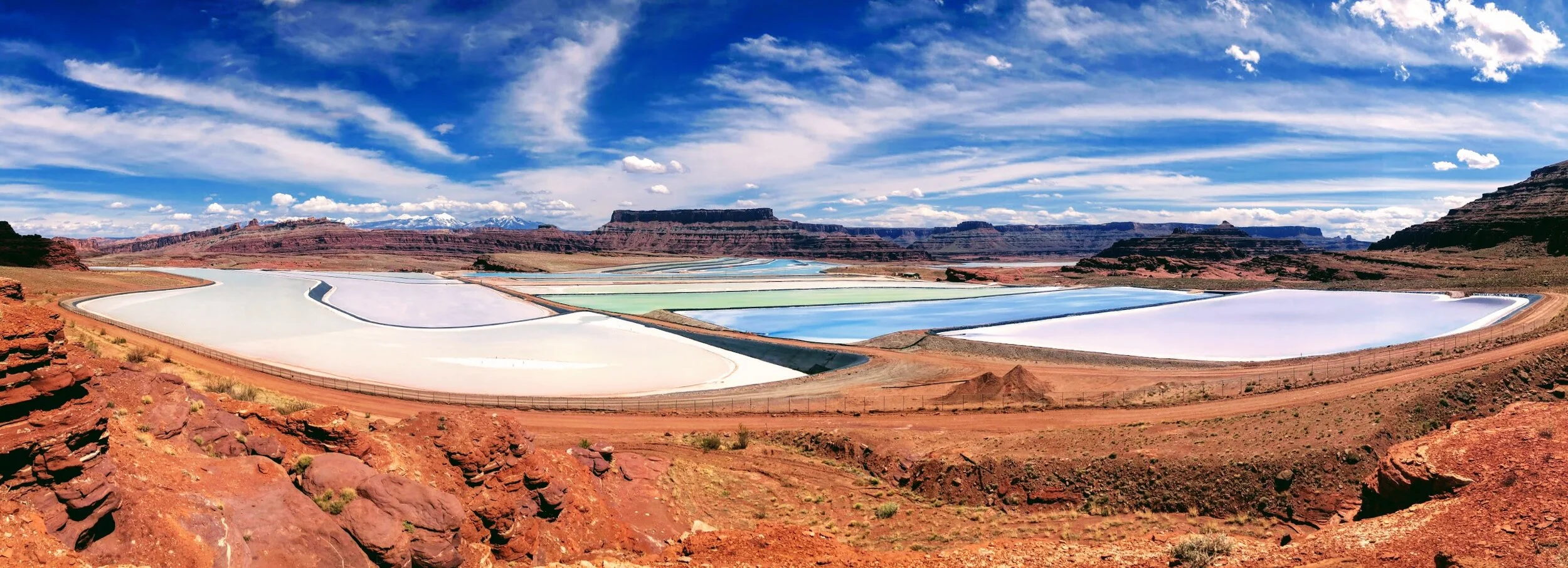
After traveling deep into the canyon, we decided to carefully turn around and head back to the main road to finish our venture down Potash Rd. towards the Potash Ponds. On the map I have pictured above, you can see very colorful lines of water: that is the Texas Gulf Potash Ponds. Potash ponds contain potassium-containing salt used in farm fertilizers and are pumped from miles below the ground. When the sun evaporates the pond water, the potash is left behind, and during the creation, you can see the many different vibrant colors of the water.
There is a large fence around the ponds keeping you at a distance, but if you climb up the rocks, you can get a great view, I have heard the ponds are best viewed from Dead Horse Point, but that was closed during COVID-19.
In the larger picture below you can see the many shades of blue, these colors can range to green and even purple.


It was getting late in the afternoon so we began the journey back to the town of Moab. We stopped at Dragonfly Canyon to peak at the river and take a few more pictures before departing.


Day 3: Travel back to Denver
With only one day to explore we left a lot to be seen for the next time we visit Moab.


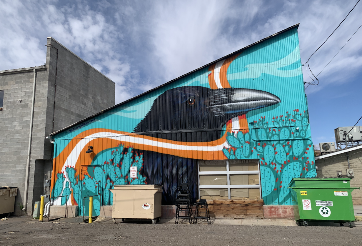
Pictured above is a few of the newer murals in the downtown Moab area.


Pictured above
Picture on the left: A view of the sandstone cliffs with Mt Waas in the background,
Picture in the middle: A barn (made to look old) in front of Arches National Park.
Picture on the right: Green oxidized iron that I found very interesting.

Moab was a short visit, but since we are only six hours away, it is easy to jump in the car and visit when we want. We will be going back to try many small local restaurants that were closed during this trip, and they have so many cute ones to choose from. We will also return to visit Arches National Park to explore. Moab is so vast that it makes it easy to visit more than a few times and still have so much to explore on the next trip.
Until next time Moab, we will see you very soon!
Airbnb = $90/night
Gas = 2 tanks
Food = Max $100